yes, so what exactly did I learn about afforestation and deforestation affecting the shape of the storm hydrograph, based on the water balance equation? Allow me to give an outdated post dedicated to it. =D
Note: In case you forgot aboutit, the water balance equation is:
P (Precipitation) = Q (Total streamflow) + E (Evapotranspiration) + (change in) Storage in bedrock and soil
(If its a whole lot of jargon, then you are not 08ip06.)
1. Afforestation
Q decreases: Due to the presence of more trees, interception increases and reduces the amount of water available in the system. This is also due to the fact that the infiltration capacity of the water increasing, and more water can be absorbed into the soil.
As such,
S increases.
E increases: As there are more trees in the area, there are more leaf coverage over the water flowing. Hence, evaporation levels are reduced. Secondly, due to the presence of trees, transpiration occurs at a higher rate.
2. Deforestation
Q increases: This is due to the fact that there is a lack of trees and agriculture in the area, and these actually allow the water to seep into the soil, reducing the amount of water that reaches the river. Hence, in the absence of tress and agriculture, it allows overland flow to occur, allowing the water to reach the river faster. Thus, Q increases. =D
E decreases: (refer to above)
S decreases: This is due to the fact that water takes a longer time to permeate into the soil, reducing the infiltration capacity of the soil and reducing the amount of water that will enter the soil and stored.
So there you go! =D
-marcus (17) JH406
Thursday, June 25, 2009
Monday, June 8, 2009
Rapids
What are rapids? Rapids is a land form predominantly seen on the upper course of the river where there is little energy in the stream and thus having little erosion capability. Rapids occur when there river bed which the stream flows over is made out of an alternating band of rock. These rocks are made of different minerals and have different densities, thus they would be eroded by the water at a different pace. The many alternating bands of differential erosion causes the river bed to rise and drop erratically, and where the stream drops from a more resistant rock band to a lower resistant rock band, the change in gradient causes an increase of velocity in the stream.
The formation of rapids is highly similar to that of a waterfall but the difference lies in the ease of erosion of the rock bands as well as the amount of alternating rock bands. The formation of rapids can also be caused my numerous large boulders or rocks that stick out above the stream surface and is hardly eroded due to the insufficient energy of the stream. These boulders create much friction for the stream and bubbles are mixed into portions of the stream causing the appearance of "white water".

-ervin JH406 (16)
Sunday, June 7, 2009
DELTAS
Deltas
So what exactly is a delta? A delta is a landform that is found at the lower course of the river, where the river flows into the oceans/seas. Deltas are formed from the deposition of the sediment carried by the river as the flow leaves the mouth of the river. River deltas form when a river carrying sediment reaches a body of standing water, such as a lake, ocean, or reservoir. When the flow enters the standing water, it is no longer confined to its channel and expands in width. This flow expansion results in a sudden decrease in the flow velocity, which diminishes the ability of the flow to transport sediments. As the velocity of the river is low, and the river have little energy left after constant erosion of the soil and the new environment that the water current is in, deposition would occur, causing boulders, rocks and pebbles to drop. When the river energy is really low, even sand, and smaller eroded particles would be deposited. Over time, all these deposition would form a landform, a piece of land, which is called the Delta.

Luke.
Friday, June 5, 2009
Hello everyone!
Here's the summary post.
So we started this module looking at the big picture, the atmosphere.
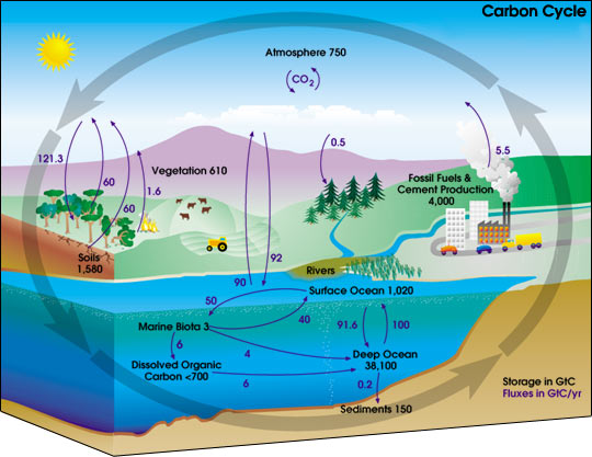
We studied the many layers of the atmosphere, the composition of air in the atmosphere as well as some of the important cycles that take place around us - the carbon cycle and the nitrogen cycle. We also learnt about the ozone layer, and its importance in sustaining life on Earth.
We then studied the importance of the Sun, and learned about the Planetary Heat Balance, which ensures a steady level of heat on Earth. We learned how the heat was divided up into longwave and shortwave radiation, and the proportions in which it is divided. We also learned about seasons, and how they are formed by the revolution of the Earth around the Sun.
We then moved on to air and wind, where we learned the 3-cell model and different wind patterns. We observed the model's relation to the formation of natural features, such as deserts. We also started learning about climates here, and the many different kinds of climates that exist. We also learned how to analyse a climograph, and to describe the climate of an area with regard to the level of precipitation, and temperature range.
We ended the Atmosphere section with the study of clouds and rain. We learned the formation of clouds by adiabatic cooling, and the 3 kinds of rain that exist. The concept of clouds and rain also provided a base from which to begin the Hydrosphere half of the module.
The hydrosphere half was certainly content-heavy. We started with the study of the water cycle. This is something all of us were familiar with from primary school, but now, we learned the more in-depth terms used to describe the various processes, such as interception, percolation, and throughflow. We studied the flow of water from the time it is precipitated as rain or snow, to the time it joins the river channel to be carried to the sea. We then moved on to the water balance equation and hydrographs, both of which enable us to see the changes in the amount of water flowing in a river. We then observed how changes made by humans could affect the water balance equation and hydrograph of a river. We studied the changes made by the introduction of agriculture, urban features as well as deforestation.
We then moved on to the study of the rivr itself. We studied the characteristics of the upper, middle and lower course of the river, noting the shape of the channel, velocity of the water as well as the processes that occur at the specific areas. With the knowledge of the processes of erosion, transportation and deposition, we were then able to understand how specific features such as waterfalls, meanders, floodplains and deltas are formed at the specific areas of the river.
With that, we end our module, with a project remaining for us to present after these holidays. The project, involving river management, will certainly help us realise how significantly human activity impacts the river and its contents.
So there's a short (HAHAHA) summary of this module!
;D
your ever-efficient (HAHAHA!) blogmistress,
-aditi.
Here's the summary post.
So we started this module looking at the big picture, the atmosphere.
We studied the many layers of the atmosphere, the composition of air in the atmosphere as well as some of the important cycles that take place around us - the carbon cycle and the nitrogen cycle. We also learnt about the ozone layer, and its importance in sustaining life on Earth.
We then studied the importance of the Sun, and learned about the Planetary Heat Balance, which ensures a steady level of heat on Earth. We learned how the heat was divided up into longwave and shortwave radiation, and the proportions in which it is divided. We also learned about seasons, and how they are formed by the revolution of the Earth around the Sun.
We then moved on to air and wind, where we learned the 3-cell model and different wind patterns. We observed the model's relation to the formation of natural features, such as deserts. We also started learning about climates here, and the many different kinds of climates that exist. We also learned how to analyse a climograph, and to describe the climate of an area with regard to the level of precipitation, and temperature range.
We ended the Atmosphere section with the study of clouds and rain. We learned the formation of clouds by adiabatic cooling, and the 3 kinds of rain that exist. The concept of clouds and rain also provided a base from which to begin the Hydrosphere half of the module.
The hydrosphere half was certainly content-heavy. We started with the study of the water cycle. This is something all of us were familiar with from primary school, but now, we learned the more in-depth terms used to describe the various processes, such as interception, percolation, and throughflow. We studied the flow of water from the time it is precipitated as rain or snow, to the time it joins the river channel to be carried to the sea. We then moved on to the water balance equation and hydrographs, both of which enable us to see the changes in the amount of water flowing in a river. We then observed how changes made by humans could affect the water balance equation and hydrograph of a river. We studied the changes made by the introduction of agriculture, urban features as well as deforestation.
We then moved on to the study of the rivr itself. We studied the characteristics of the upper, middle and lower course of the river, noting the shape of the channel, velocity of the water as well as the processes that occur at the specific areas. With the knowledge of the processes of erosion, transportation and deposition, we were then able to understand how specific features such as waterfalls, meanders, floodplains and deltas are formed at the specific areas of the river.
With that, we end our module, with a project remaining for us to present after these holidays. The project, involving river management, will certainly help us realise how significantly human activity impacts the river and its contents.
So there's a short (HAHAHA) summary of this module!
;D
your ever-efficient (HAHAHA!) blogmistress,
-aditi.
Hydrographs
 Ok, firstly, hydrographs are graphs which show river discharge over a given period of time and show the response of a drainage basin and its river to a period of rainfall.
The discharge of the river is calculated in cumecs/cm^3.
Secondly, 2 most important things we must take note of a hydrograph are the lag time and the shape of the graph.
Lag time is the time between the peak rainfall to peak discharge, as stated in the diagram above.
Factors which affect the lag time are:
1. vegetation
2. humidity
3. precipitation
4. relief of drainage basin
5. overland flow [ water flowes fastest ]
6. through flow/ groundwater flow [ water flows slowest ]
These factors determine the speed at which water reaches the river.
A shorter lag time will mean that water had flowed quickly to the river.
A longer lag time will mean that had flowed slowly to the river.
A steep or gentle gradient will result from the duration of the lag time and affect the shape of the graph.
Steep: Short lag time, higher peaks
Gentle : Long lag time, lower peaks
Factors which affect the shape of the graph are:
1. Geology of the drainage basin [ Eg. impermeable or permeable bedrock ]
2. Distance between infiltration and the river
Examples:
Urbanisation
In urbanised areas, vegetation has been replaced by tarmac and cement surfaces. This will prevent infiltration of precipitation into the soil, resulting in significant overland flow. In addition, complex drainage and pipe systems in these urbanised areas will increase interception of precipitation. Hence, precipitation will be transported quickly to the river, decreasing the lag time, resulting in a steep sloped hydrograph.
The same goes for grazing and deforestation. In these 2 other examples, vegetation has also been removed. Hence infiltration and interception of precipitation will decrease and surface run-off will increase. A steep-sloped hydropgraph will result as well.
Afforestation
In afforested areas, vegetation is present. Infiltration will increase as the roots of the plants provide pathways for precipitation to percolate underground. Interception [ stem flow and through fall] will increase as well. In addition, evapotransiration will occur. When these happen, lag time will increase as precipitation takes a longer time to reach the river and thus giving a gentle sloped hydrpgraph.
Our lovely IS2104 hydrosphere booklet
That's all!
The end:):):)
Wednesday, June 3, 2009
Shapes Of Valleys Formed At Various River Courses
 Heyho(:
 This blog entry is to basically help you understand more about the shape of the valleys formed at the upper course, the middle course and the lower course.
The river is generally divided into three courses, the upper course, the middle course and the lower course. And this is due to the rate of erosion and deposition occurring at each course and other factors, which have been described below, and therefore, valleys are formed.
The upper course of the river is usually the young part of the river, usually where the flow of water begins from or also known as the river mouth. The middle course is known as the mature stage and the lower course is as such known as the old stage of the river.
The Upper Course
The upper course is located usually at the top of the river and has the steepest gradient compared to the other parts of the river. Therefore, water flows quickly through the channel and over time, the sides of the channel get weakened by weathering processes and erosion occurs in a downwards direction. It is also known as vertical erosion. Slowly, the mass movement of materials occurs down the valley sides and creates a v-shape. Vertical erosion is the cause many other landforms and for the steep sloping v-shaped valley formed at the upper course. Vertical erosion usually occurs in form of abrasion, hydraulic action and solution. The overall energy present for vertical erosion to take place is very high and more than lateral erosion and as such, the river continues to cut down vertically. Also, very little deposition takes place at the upper course.
Middle Course
Middle Course
In the middle course, the river channel becomes wider and deeper as the river, as the channel has been eroded and it is also due to the many tributaries that have begun to branch out from the river. The velocity of the water flowing in the middle course is decreased as compared to the upper course as the gradient is lesser steep. Therefore, the surrounding valley has become wider and flatter and additionally, there is a more extensive floodplain present. Due to the unique pattern of erosion and deposition and bends in the middle course of a river, landforms such as meanders, slip-off slopes and oxbow lakes are formed. Wider lakes can also be found at the middle course of the river.
Lower Course
At the lower course of the river, water begins to run even more slowly as the gradient of the river becomes lesser steep. Therefore, lesser erosion and more deposition takes place. Usually a wide floodplain is formed here as such. And floodplains are also formed when there is a heavy rain and the river’s water level rises and the average speed of water flowing increases. And that causes the deposited material or other fine material to be in suspension. Then, due to the increased speed of water, the river overflows its banks and deposits its load. And slowly, a small layer of load is laid at both sides of the river. The layer of load or material is also known as alluvium and this eventually forms a level of land called a floodplain. The shape of the valley in a lower course river is usually the widest and in a u-shape.
Definitions of some of the key words used above:
Erosion: The group of natural processes, including weathering, dissolution, abrasion, corrosion, and transportation, by which material is worn away from the earth's surface.
Deposition: The act of depositing, especially the laying down of matter by a natural process.
Tributaries: A small river which eventually joins or branches out from the main river.
Floodplain: A flood plain is a level stretch of land found on both sides of a river in its mature and oldstages.
Done by:
Subha(:
jh406.08
Tuesday, June 2, 2009
Transportation in River Channels
HELLO!! EVERYONE.
I will be blog on one kind of river channel processes--Transportation.
Rivers have energy. (As a reminder, rivers' energy come from two sources--kinetic energy as well as potentional energy. Thus the factors affect the energy of a river are, just to name a few: gradient of land, roughness of channel, shape of channel cross-section, volume of river...etc) After successfully overcoming friction, energy is used to carry or transport eroded materials such as mud, sand, boulders and dissolved materials. These materials are called its load. River transport their load by four processes. These processes are traction, saltation, suspension and solution.
Traction: larger particles like pebbles and boulders roll and slide along the river bed. They move only if the speed of the river is great enough to move them. Some of them are so heavy that they can only be rolled along during heavy flooding.
Saltation: large particles such as gravel and coarse sand are lifted and dropped along the river, so they bounce along the river bed in a series of bed.
Together, the saltation load and the traction load form the bedload.
Suspension: fine particles such as clay, silt and fine sand are carried along without contact with the river bed. Materials carried in suspension(suspension load) usually forms the greatest part of the total river load and this exlains why most rivers look muddy.
Solution: soluble minerals(dissolved load) in the rocks such as salts of calcium and sodium are carried away in solution . Trying to look out for these type of load in a river? Too bad, they cannot be seen by a naked eye. Solution occurs even when the speed of the river and its volume of water are low.
Yup:) So that's all about trasportation. If you are unsatisfied, or still get something unclear, ahha, then maybe you would like to watch this short yet cute video about river transportation:
http://www.youtube.com/watch?v=IhWrn6ys1Wc
IS2104 is over, yet I think (Physical) Geography should not end here. Geography is both useful and interesting. USA's 35th president Joh F. Kennedy said" Geography has made us neighbours." And believe it or not(don't believe it), famous scientist Albert Einstein said:""As a young man, my fondest dream was to become a geographer. However, while working in the customs office I thought deeply about the matter and concluded it was too difficult a subject. With some reluctance I then turned to physics as a substitute."-----Actually this is a blunder, to find out more, visit this http://geography.about.com/od/geographyglossarye/g/ggeinstein.htm
I think (Physical) Geography is not about maps, nor about memorisation of facts. The learning of Geography to a certain extent is about learing our home--the Earth.
Done by Cao Li :) JH406(13)
Subscribe to:
Posts (Atom)